
By Inbal Ofer
As a social historian I have always found public services to be a fascinating domain of research. They are a meeting point between theories of progress and the practicality of everyday life, and between the aspirations of professionals, the dictates of national, regional and local bureaucracies, and the needs of different users. Researching the planning, implementation, and uses of public services calls for work in different types of archives and an engagement with oral sources (never a dull moment). When I first became interested in urban history, I found the acquisition of effective skills for the analysis of the production of space challenging. Bridging the gap between descriptive documents, plans, and designs, and the experiences of inhabiting space was something I struggled with for a long time (and still do sometimes).
Perhaps it was my interest in public services that first drew me to examine transportation infrastructures. I found these infrastructures easier to analyze. I soon realized that it was not only a convenient starting point, but also one that made sense in analytic terms. Transportation infrastructures enabled me to think in terms of center and periphery, of flows and uses; they provided me with information regarding the ways in which urban space was conceived and regimented. As someone who lives in Israel—a state with a large ‘periphery’ relative to its small size—I was always aware of the fact that deficient transportation infrastructures defined one’s possibilities in terms of education, work, medical services, and social networks. As a researcher I soon learnt that zooming-in on such deficiencies provided me with clues regarding the informal production of space, especially that space and those spatial practices which diverge from the plan.
The city of Madrid has always been at the center of my research projects, whether I analyzed the relationship between gender and fascism or the production of urban informality and the formation of urban social movements. Transportation infrastructures in Madrid expanded significantly in terms of their outreach, volume, and form over the past five decades. From the 1970s onwards, a new system of radial and concentric roads and highways was progressively erected. The system, which connected the barrios of the expanding metropole to each other and to the center of the capital, reversed three decades of dictatorial planning that aimed to create a segregated city in terms of populations and land uses. The Metro and bus systems expanded more rapidly towards the northern suburbs of Madrid and up to the natural boundary of the Manzanares River to the south. During the first two decades of the twenty-first century, the southern barrios between Usera and Villaverde were also partially connected to the Metro and to the commuter train system (Cercanias). However, it is not the historical evolution of public transport in Madrid which makes it a suitable topic for my ode, but rather the professional and personal insights which I gained by using it myself.
For the past fifteen years, when in Madrid, I have lived on the southern outskirts of the capital (as defined by pre-Civil-War maps). The archives where I conduct my research are situated, for the most part, north of the river. But the people whom I interview and form the heart of my research, as well as many of my friendships, are to be found on the other side of the river, in those areas that were integrated into the capital’s municipal area in the 1950s and 1960s. By choice I use public transportation during my research trips. Over the years I learned to appreciate the time spent in public transport as time for reflection. In particular, bus no. 60, as I jokingly explain to some of my students, represents for me an “archive in movement.” The line runs between Plaza de la Cebada (situated on the outskirts of the touristic barrio of La Latina) and the barrio of Orcasitas. During the 1950s and 1960s, Orcasitas constituted one of the last frontiers for those arriving to the capital from Toledo and Andalucia. It was there that several thousands of them erected their chabolas (shanty homes), turning the land (ravaged by the Civil War, sparsely populated and mostly owned by one family) into an organic extension of the capital.
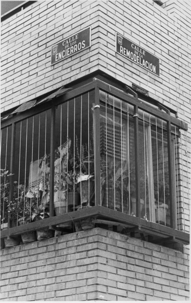
Bus no. 60 is rarely used by tourists, nor I guess by most historians, and yet it tells the very story of Madrid’s expansion to the south. As I take the bus I often write comments in my “bus notebook.” The following lines offer a few examples: “Archived plans reflect the ways in which the different functions of an urban center are constituted and reinforced by built form, the functions assigned to buildings and the center’s accessibility.” The practical implications of some of these plans are made clear when one takes bus no. 60. When running from Orcasitas to La Cebada, it is never empty, and depending on the time of day and the travelers’ profiles one can easily compose a list of the functions which the “center” holds for those living away from it (work, leisure, shopping, and even education, in the case of teenagers). The buses which run in the opposite directions, on the other hand, testify to the “periphery’s” lack of attraction to those who do not inhabit it. Looking out of the window as the bus crosses the river into Usera, one can see concrete examples of different social housing projects from the 1950s to the 1980s. Each of these projects represents a specific design, architectural (and in my view also ideological) logic, and economic dictates. Each building, block, and neighborhood are embedded in the urban fabric via different infrastructures and intermediary spaces. Street names, in their turn, provide clues regarding the era in which a structure or a block were integrated into the formal city-plan, as well as of the neighbors’ ability to influence urban collective memory. Street names in Orcasitas, for example, point to the history of Madrid’s industrial development (Dodge, Simca) as well as to the community’s civic struggle during Spain’s transition to democracy (Plaza Asambleas, Plaza Solidaridad, calle de las Cooperativas).
The process of urban expansion in Madrid, and the interaction between formal planning and the informal production of space, are relatively well documented. And so, almost everything I have just written can be schematically and conceptually grasped, at some level, through archival work. Architects and planners left behind rich verbal and visual testimonies of their works, treasures for a grateful historian. And yet none can replace that special awareness which supplements the so-called “formal” sources, and comes with inhabiting and moving through space via the very medium which I investigate.
Inbal Ofer is an associate professor of modern history in the Department of History, Philosophy, and Judaic Studies at Open University of Israel. Her research focuses on gender and fascism, urban history, and the history of urban social movements in twentieth-century Spain. She is the author of Claiming the City and Contesting the State: Squatting, Community Formation and Democratization in Spain (Routledge, 2017).
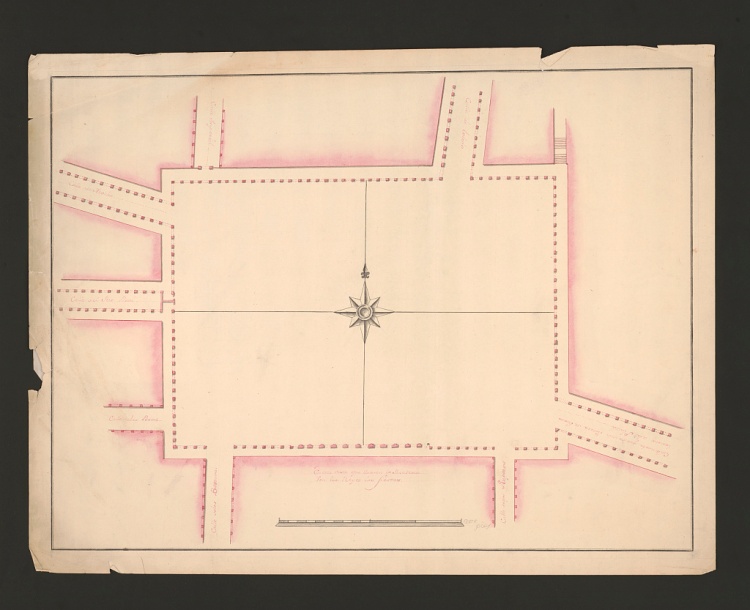
Featured image (at top): Juan Gómez De Mora (Architect), “Plaza Mayor, Madrid, Spain, Plan” (1626), Library of Congress Prints and Photographs Division.
